GIS Spatial Data Types
In GIS, there are 2 basic spatial data types representing the real world:
Raster and Vector
The Real World 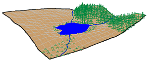
In this example, our landscape consists of
- rolling hills
- grassland
- lake
- rivers
- forest stands
- marsh
It can be represented as a series of raster layers and/or vector layers.
Raster Data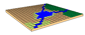
In the raster data model, land cover is represented as:
Each cell will have a value corresponding to its land cover type.
Raster data are good at:
- representing continuous data (e.g., slope, elevation, chemical concentrations)
- representing multiple feature types (e.g., points, lines, and polygons)
as single feature types (cells)
- rapid computations ("map algebra") in which raster layers
are treated as elements in mathematical expressions
- analysis of multi-layer or multivariate data (e.g., satellite image
processing and analysis)
- hogging disk space
Vector Data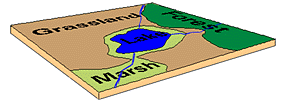
In the vector data model, features on the earth are represented as
- points
- lines / routes
- polygons / regions
- TINs (triangulated irregular networks)
Vector data are good at
- accurately representing true shape and size
- representing non-continuous data (e.g., rivers, political boundaries,
road lines, mountain peaks)
- creating aesthetically pleasing maps
- conserving disk space
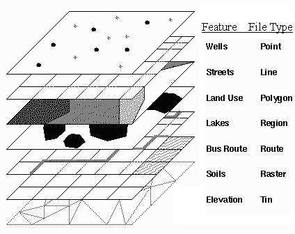
Different types of data are
stored in different
file formats.
images © ESRI
How are information about spatial features stored in a GIS?
back to Spatial Referencing 
 on to Attribute
Data
on to Attribute
Data