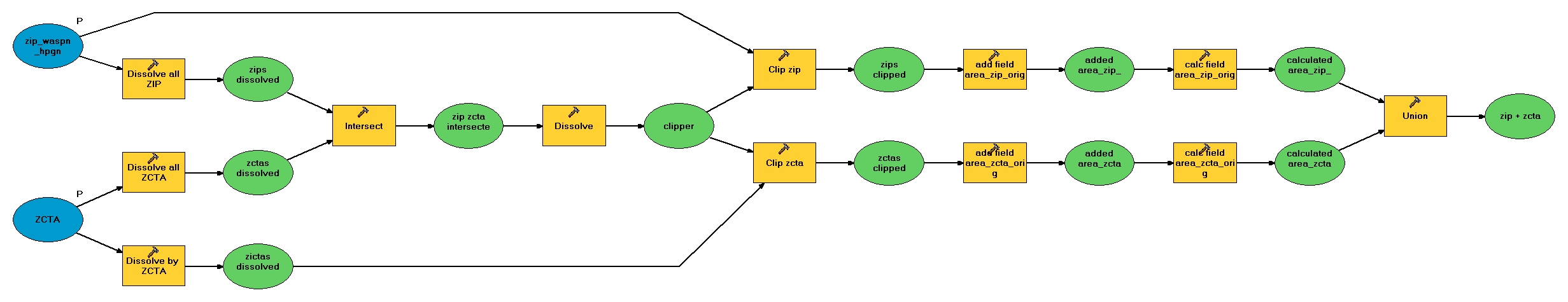
The steps outlined in the section on GIS analysis can be done in an ArcGIS model.
Here is a toolbox containing the model, as well as a Python script. These are not guaranteed to work, but if you follow the logic you should get the results you need.
Back