Attribite values in a GIS are stored as Relational Database tables.
Each feature (point, line, polygon, or raster) within each GIS layer will be represented as a record in a table.
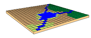
Let's look back at the landscape example from earlier:
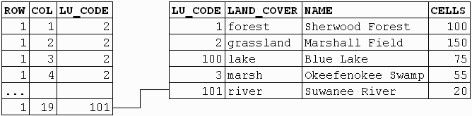
This raster data set will be associated with a table of values.
Each cell has a coordinate representation within the table and a numeric value (i.e., LU_CODE).
Each LU_CODE is associated with a full description through a relational join.
The vector data attributes are also held in database tables.
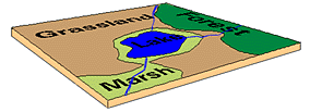
Because the vector data represent both linear and polygonal features, there will be 2 attribute tables:
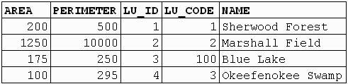
Polygon attributes
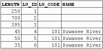
Line attributes
How do you get data into a GIS?
back to Spatial Data Types ![]()
![]() on to GIS
Data Input
on to GIS
Data Input