Overview:
With the exception of raster data, ARC/INFO and treats all objects as individual features (e.g., forest stands, stream reaches, road segments, bird nests). LMS focuses on the forest stand as an individual object which is tracked through time. Many of the features you use in ARC/INFO, such as roads and streams, will also be used in LMS, but only in display, not in silvicultural analysis. Thus, the amount and type of feature-level data preparation will differ from theme to theme in the GIS database. Typically, all themes other than forest stands are exported as MOSS files, with no supporting data, whereas forest stands are exported to MOSS files, and the stands PAT is also exported from INFO to be imported to the LMS stand table.
How you want LMS to display landscape data will determine what themes you will need to prepare for export. If you want your landscape view to include roads and streams, these themes will need to be prepared for export. A study area boundary is also helpful. However, the forest stand coverage is the only necessary theme that needs to be exported. Other themes are very useful in orienting the viewer's eye and in making the landscape look more realistic.
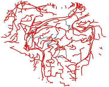
Streams
If you want to display streams on your landscape view, you may or may not wish to select out streams matching certain criteria. For example, you may want to display only streams of DNR types 1-3. In this case, you will need to create a new coverage containing only these stream segments. Use the RESELECT command in Arc:
Usage: RESELECT <in_cover> <out_cover> {in_feature_class} {selection_file}
                {out_feature_class}

Arc: reselect str2 str_1-3 arc
 Reselecting LINE features from STR2 to create STR_1-3
Enter a logical expression. (Enter a blank line when finished)
>: reselect str2dnrty gt 1 and str2dnrty le 3
>: <CR>
Do you wish to re-enter expression (Y/N)? n
Do you wish to enter another expression (Y/N)? n
 17 features out of 520 selected.
 Reselecting lines...
Number of Arcs in Coverage...     520
Number of Arcs Reselected....      17
 Creating STR_1-3.aat...
18 unique nodes built for E:\ARC_LMS\STR_1-3
Arc: ap
Arcplot: disp 9999
Arcplot: mape str2
Arcplot: arcs str2
Arcplot: arclines str_1-3 6
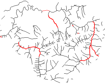
Roads
You may wish to perform a RESELECT to generate a coverage of only major roads before creating your MOSS files. The Pack Forest roads coverage includes trails, which are generally not visible at the landscape scale. These should not be put into the MOSS file for roads.
Arc: reselect rds2 rds_no_trail arc
 Reselecting LINE features from RDS2 to create RDS_NO_TRAIL
Enter a logical expression. (Enter a blank line when finished)
>: reselect rds2_desc1 ne 'TRAIL'
>: <CR>
Do you wish to re-enter expression (Y/N)? n
Do you wish to enter another expression (Y/N)? n
 670 features out of 698 selected.
 Reselecting lines...
Number of Arcs in Coverage...     698
Number of Arcs Reselected....     670
 Creating RDS_NO_TRAIL.aat...
 Creating RDS_NO_TRAIL.NAT...
Arc: arcplot
Arcplot: mape rds2
Arcplot: arcs rds2
Arcplot: arcl rds_no_trail 6
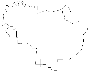
Boundary
UTOOLS displays are enhanced by a boundary theme. If you do not have a coverage of the study area boundary, you should create one, either by digitizing an single polygon whose extent is greater than the outermost extent of your other data.
If the outer hull of your forest stands also represents the extent of your boundary, you can create a polygon coverage with a single polygon based on this outer hull:
Add an item that will have the same value for all polygons.Arc: additem tty4.pat tty4.pat flag_dissolve 1 1 iCalculate the flag_dissolve item = 1 for all stands.Arc: tables Enter Command: select tty4.pat 188 Records Selected. Enter Command: res area gt 0 187 Records Selected. Enter Command: calc flag_dissolve = 1 Enter Command: q Leaving TABLES...Dissolve now.Arc: dissolve tty4 bound flag_dissolve poly Dissolving tty4 by flag_dissolve to create bound Creating bound.PAT format... Creating dissolve table... Dissolving... Number of Polygons (Input,Output) = 188 2 Number of Arcs (Input,Output) = 536 8 Creating bound.PAT... Creating bound.NAT...Display the new coverage.Arc: ap Arcplot: disp 9999 Arcplot: mape tty4 Arcplot: arcs tty4
You may also create boundary coverages if you are preparing data on a watershed level by dissolving sub-basins into a single super-basin coverage.
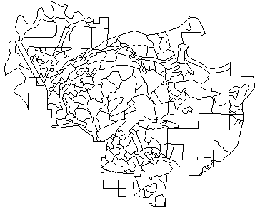
You will need to decide what database table items to export, both as part of the output MOSS files, and as part of the forest stand PAT. In general, you will need to know the composition of your FATs in order to know how the attributes will be carried over to LMS. You will need to know which items are important, and which ones you can drop.
The stand PAT is essential to export, since it will contain various necessary data for input to the growth models in LMS. In addition, the internal numbering sequence should be used to create the MOSS file for the forest stands. This will assure that stands are displayed with the correct symbology in UTOOLS.
If you wish to display linear features in different colors based on an attribute in the theme's AAT, that attribute item will be used in the ARCMOSS conversion. Likewise, if there are polygonal features you wish do display differently, such as lakes, wetlands, or other open water, you will need to either use existing attribute items, or create and populate new attribute items.
The most important step in generating export data from ARC/INFO to LMS is making sure the forest stand polygons have the correct attributes, and that those attributes, as well as the MOSS data, are exported correctly.
The basic stand-level attributes you will need for growth modeling are
slope, aspect, and elevation.
However, there is a real problem with generating mean aspect per stand. As I mentioned before, a simple arithmetic mean does not work. Imagine a stand represented by 100 cells. 50 of those cells face north-northwest (aspect ~ 315), while the other 50 cells face north-northeast (aspect ~ 45). The arithmetic mean of these cells is 180 [(50 * 315) + (50 * 45)]/100, which is due south! The stand's true mean aspect should face north (0).
In order to generate mean aspects, the aspect grid must be converted to sine and cosine measures in radian angles. Calculations are performed on these grids, and then converted back to degrees. Finally, new zones result with the mean aspect per stand, and the resultant numbers can be related back to the forest stand coverage. The method for doing this calculation is explained in section 24.4 of Zar's Biostatistical Analysis.
I have written an AML (zonalmeanaspect.aml) that will perform all of the necessary steps of generating mean aspect per stand. You can use this AML to generate your data. Also take a little time if you like, to read through the AML and figure out how it works.
Create coverages for Pack Forest: